ALL YOU’LL WANT TO KNOW ABOUT LIVING ON THE POINT!
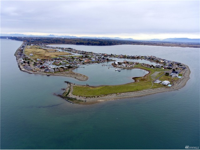
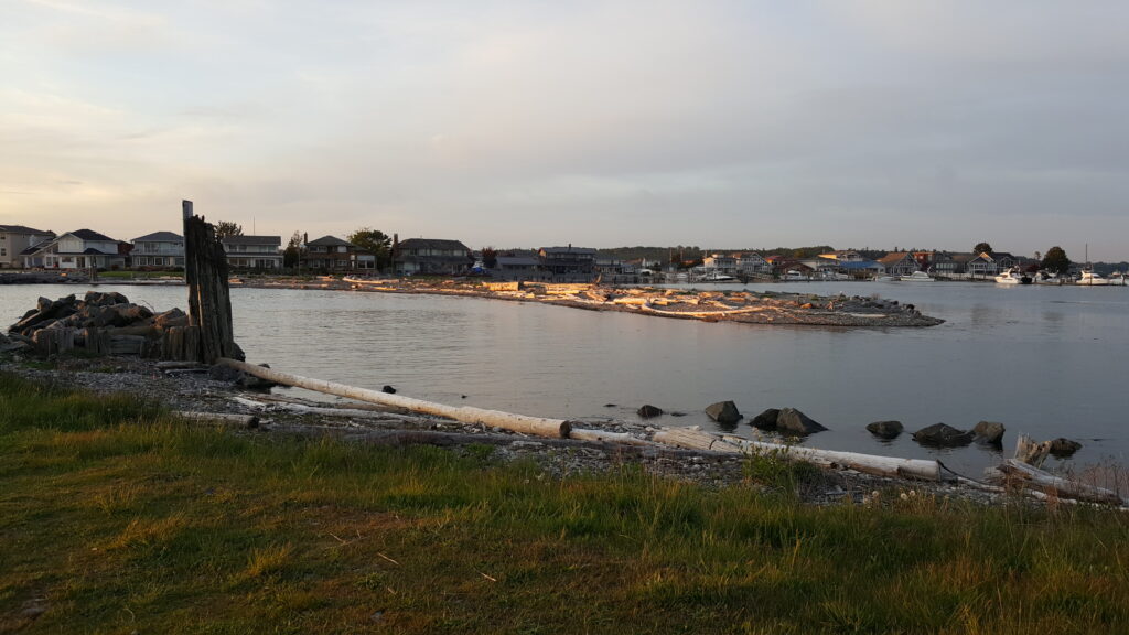
The Entrance to Sandy Point Harbor
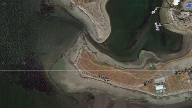
In the Composite Photo, above:
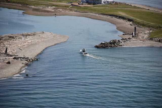
Top Photo show aerial view of shoaling.
Next Photo show the safe course. Obstructions are noted in Red.
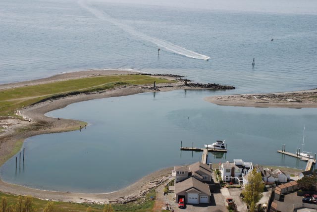
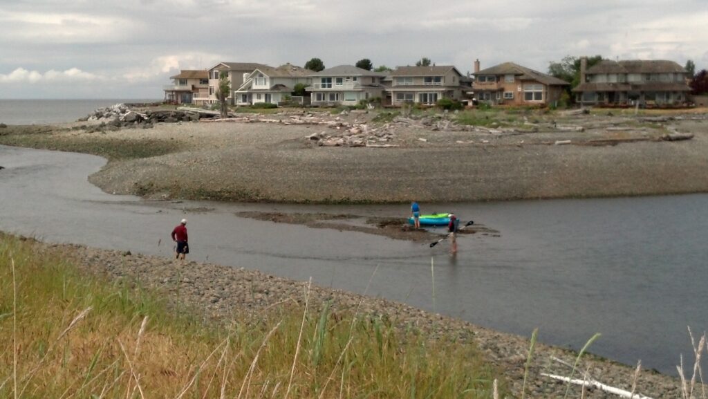
Lower Panorama Photos shows kayaks and beach combers at a:
Minus 2′ Tide. Note that some boats can still get out if the course is followed.
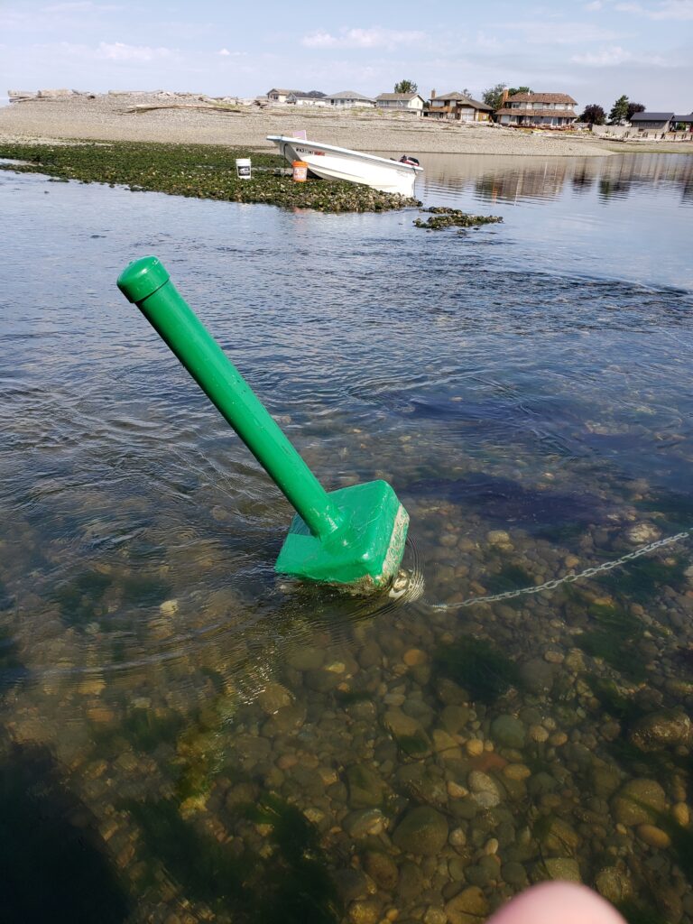
Lower Left Photo is of the rock just inside the breakwater tip.
Right Click to Save/Print this Composite Photo
__________________________________________________________________________________________
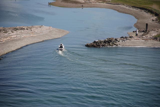
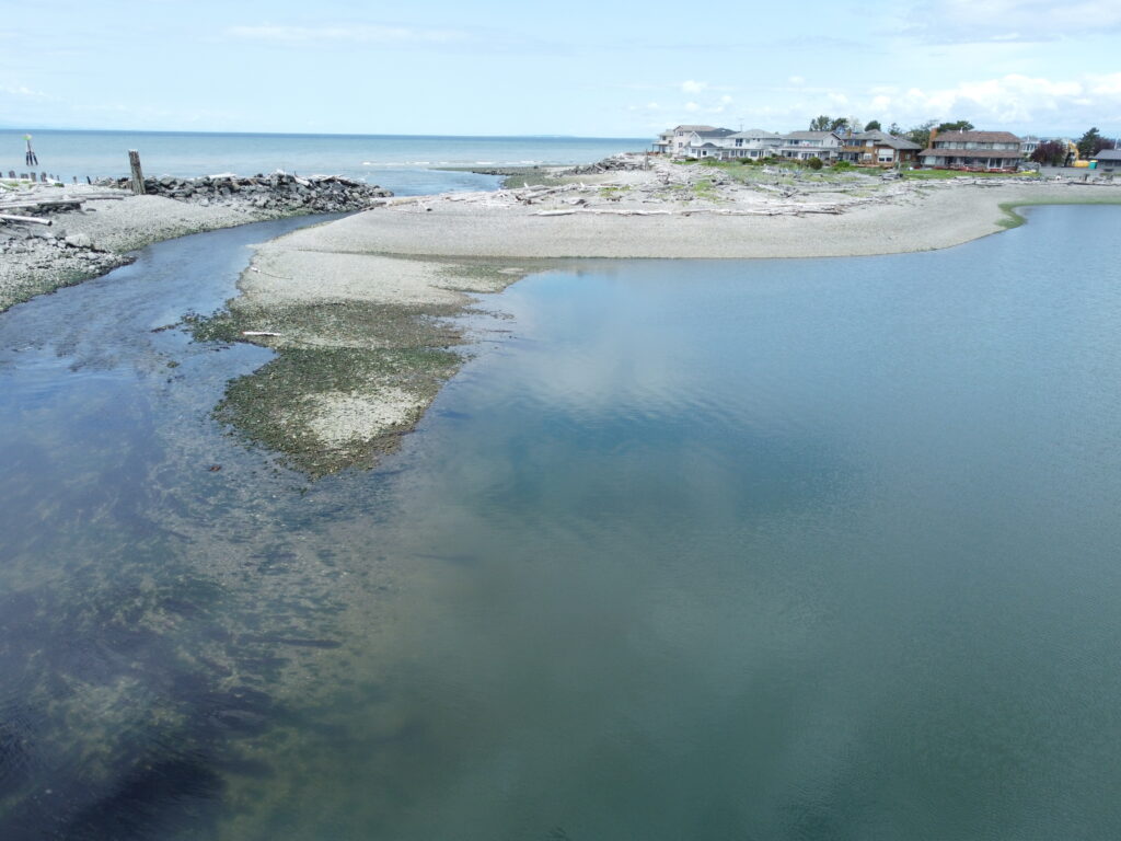
At a (-) 3.4 foot tide – –
This is what is underneath the water that you’ll be going through.
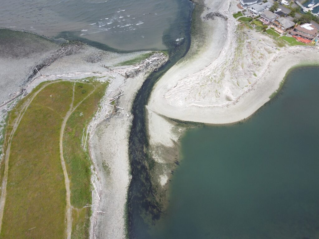
And a Zoom-in on the end of the Gravel Bar.
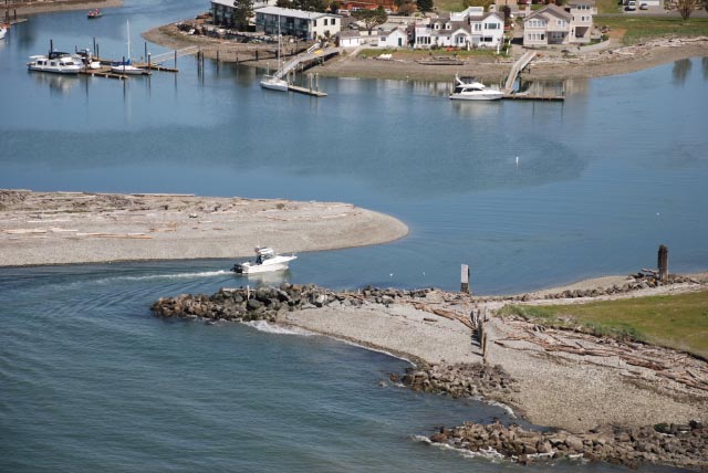
At a 5’+ tide, You’d never know there as any thing to be aware of – –
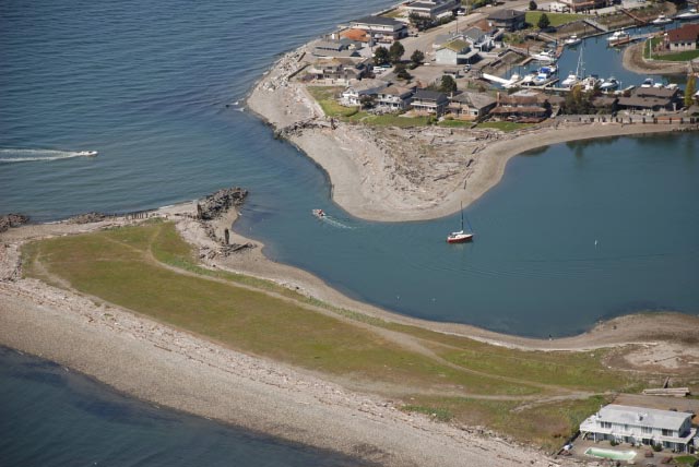
Or when it looks like this – – – at a 9′ tide
________________________________________________________________________________________
This Video (link below) shows the course you’ll need to steer to get in or out safely. Don’t cut the Corner! With a 36″ draft, you will need at least a 4′ tide, however what you “need” and what is “comfortable” will depend on current & wind conditions (& how much adrenaline you can stand). Note the “hard 90” at the Green buoy (don’t hit the buoy – it’s $$ & privately maintained). A 5′ tide will allow most boats with up to a 5′ draft to come in safely. Keep in mind that coming in for the 1st time, & steering from a fly-bridge can be terrifying, as you’ll be seeing down into very clear water & seeing every rock. Try it from the lower helm the 1st time in. If the current is running hard, you’ll need to be on the throttle(s) – – – –
Click this link: On Your Way Out – – –
To see a “Fly In” at near high tide (entrance from the Straits), click here
__________________________________________________________________________________________
But if it looks like this – – you might want to pick another day – –
Minus 3.0′ tide – – Nothing comes in or goes out.
The Photo above, shows the “River Running”, sometimes 5+ knots.
________________________________________________________________________________________________
Sandy Point Marina
The Marina is owned by SPIC and is for the use of SPIC members. For a fee, non-members may be able to use the facilities. There is a Marina Office, BBQ building, gated Launch Ramp, and Dry-Storage Area.
In the photo, above, the boats, ramps and docks on the right side are privately owned by separate properties.
Gas is available at the Marina Fuel Dock, next to the launch ramp.
Launch Ramp
If you have access to, and are using the launch ramp you’ll want to be very aware that there is an 18″ to 2′ gap between the floating dock and the ramp edge. Trying to get your boat close to the dock could mean that you drop a wheel off the ramp edge. There are lots of different “potentials” – – none of them good. You’ll also want to be aware that at an extreme low tide, your trailer may back off the end of the ramp (a drop-off), making it very difficult to retrieve.
Access during Westerly winds can become dangerous, as an outgoing current, flowing into a wave coming from the West can cause breakers in the entrance. Coming in, you may be able to ride the crest of a breaker, (and not “bottom out”), but keep in mind that, if you come off the crest, you may be parked on the bottom, and be an easy target to take the next incoming wave over your stern. On departing, there may be enough water in the channel, itself, but if you punch out into the trough of an incoming wave, you may be sitting on the bottom – – momentarily.
Sandy Point & Neptune Beach
- Home
- About
- Neptune Beach
- Neptune Heights
- Sandy Point
- Sandy Point Heights
- Marine Navigation
- Homes Property
- Links
- History
- Contact
- Tsunami Risk Info